Shape Communities. Grow Your Career.
We know that building great communities starts with teams made up of great people. If you’re exploring ways to collaborate and make an impact, join us.
Explore Career Opportunities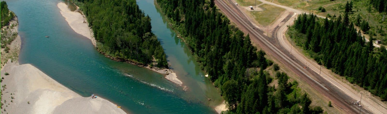
Columbia Falls Aluminum Company (CFAC), is located two miles northeast of Columbia Falls in Flathead County, Montana. An electrolytic aluminum reduction facility, originally constructed by Anaconda Aluminum Company, was previously located at the site. The industrial portion of the property covers approximately 960 acres adjacent to the Flathead River and was in operation between 1955–2009. In 2016, the CFAC site was listed on the National Priorities List under the Environmental Protection Agency’s (EPA) Superfund program.
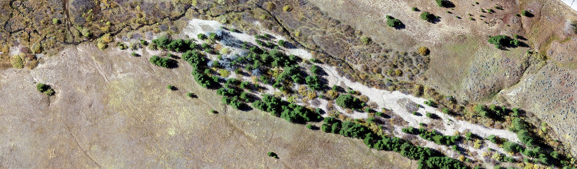
Stormwater and wastewater from a portion of the plant was discharged into three cascading infiltration ponds constructed adjacent to the Flathead River. These ponds, referred to as the South Ponds, were originally constructed with an earthen dam at the east end of an old seasonal side channel to block active river flow. The water discharged to the South Ponds and included suspended solids in the wastewater that deposited a sediment layer in the bottom.
Topographic survey
Environmental resource documentation
Resource agency consultation
Compliance with Applicable or Relevant and Appropriate Requirements (ARAR’s)
Civil engineering design
Constuction contract administration
Public outreach support

Two of the initial tasks in the EPA Superfund process are Remedial Investigation (RI) and Feasibility Study (FS). Through the RI/FS, materials were identified in the upper pond sediment layer that were found to be above ecological risk thresholds.
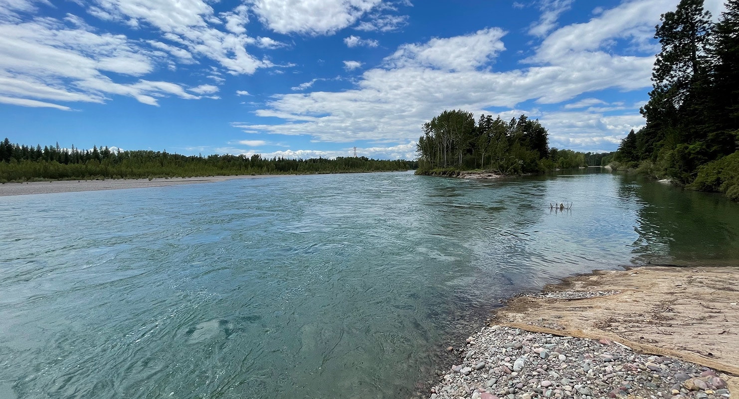
When the South Ponds were initially constructed, the main channel of the Flathead River was along the south riverbank. Over the years, natural river migration and high flows had required occasional maintenance of the earthen dam retaining the South Ponds. However, the pace of natural river migration had increased over the past several years to the point that the main channel of the river had shifted from the south bank to the north bank. This natural river migration resulted in constant hydraulic attack and was eroding the earthen dam and the island area that separated the river’s main channel from the South Ponds. The accelerating river migration increased the risk of erosion and transport of the sediment layer in the South Ponds into the Flathead River system.
In 2016 and 2017, Morrison-Maierle assisted CFAC with two projects to stabilize the earthen dam and mitigate river erosion and migration into the South Ponds. These projects fixed the natural migration of the Flathead River but didn’t eliminate the possibility that the river migration – and the erosion that comes with it – could extend beyond the stabilization and transport sediments from the South Ponds.
In early 2020, CFAC initiated an Early Action within the EPA Superfund process to address the need to remove impacted sediments from the Flathead River’s migration zone and return the river to its natural condition. CFAC worked with Morrison-Maierle and environmental consultant, ROUX Inc., to develop a plan to remove the impacted sediments from the South Ponds. The team engaged local, state, and federal stakeholders for their input and agreement. The plan was developed on an accelerated schedule with the goal of removing the impacted South Ponds’ sediment layer prior to the spring runoff in 2021.
The project was designed and constructed in two phases. The first phase included:
The second phase included:
In addition to mitigating the risk of erosion and transporting impacted sediments from the South Ponds, CFAC also removed all man-made features in the South Ponds island area, which returned the site to its natural condition and reduced the need for future operation and maintenance tasks in the Flathead River floodplain.
The project was constructed between October 2020 and April 2021 on an accelerated pace during the river’s seasonal low flow. Completion prior to spring runoff also ensured that impacted sediments would not be incorporated into the Flathead River system.
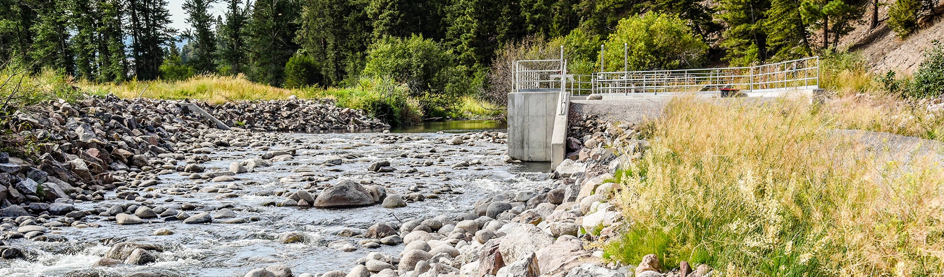
Allendale Canal and Fish Screen is part of the Flint Creek Water Project, owned by the Montana Department of Resources and Conservation (DNRC) and operated by the Flint Creek Water Users Association.
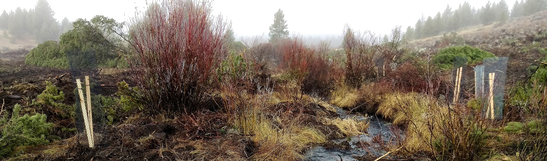
The French Gulch and Moose Creek Restoration Project restored over four miles of stream and floodplain on public land that had been extensively mined in the 1800s.
Morrison-Maierle’s Oregon Creek Stream restoration project designed and used an advanced monitoring technique to create 1,400 lineal feet of new stream channel and four acres of new floodplain.

We know that building great communities starts with teams made up of great people. If you’re exploring ways to collaborate and make an impact, join us.
Explore Career Opportunities